Postal codes in the Dera Ismail Khan GPO region, Khyber Pakhtunkhwa, are five-digit numbers assigned by Pakistan Post to ensure the efficient sorting, routing, and delivery of letters, documents, parcels, and other mail throughout Dera Ismail Khan District and surrounding areas.
Region: Dera Ismail Khan GPO, Khyber Pakhtunkhwa, Pakistan
Regional Headquarters: Dera Ismail Khan
Main Postal Code: 29050 (Dera Ismail Khan GPO) – General Post Office for Dera Ismail Khan
Dera Ismail Khan postal codes include delivery post offices and postal facilities operating under the Dera Ismail Khan General Post Office (GPO) and its associated account offices. These postal codes help facilitate accurate mail delivery between Dera Ismail Khan and major cities including Islamabad, Peshawar, Lahore, Karachi, Quetta, Multan, Bannu, Tank, and other parts of Pakistan.
Dera Ismail Khan Postal Code List Pakistan
| Name of Delivery Post Office | Post Code | Account Office | Province / Region | Branch Office |
|---|---|---|---|---|
| BAND KURAI | 29162 | Dera Ismail Khan GPO | Khyber Pakhtunkhwa | 29163 |
| BILOT | 29170 | Dera Ismail Khan GPO | Khyber Pakhtunkhwa | 29171 |
| CHISHMA RIGHT BANK CANAL D.I KHAN | 29190 | Dera Ismail Khan GPO | Khyber Pakhtunkhwa | 29191 |
| CHOUDHWAN | 29330 | Dera Ismail Khan GPO | Khyber Pakhtunkhwa | 29331 |
| D.I KHAN AGRICULTURAL RESEARCH CENTER | 29120 | Dera Ismail Khan GPO | Khyber Pakhtunkhwa | 29121 |
| D.I KHAN POLYTECHNICAL INSTITUTE | 29090 | Dera Ismail Khan GPO | Khyber Pakhtunkhwa | 29091 |
| DARABAN | 29310 | Dera Ismail Khan GPO | Khyber Pakhtunkhwa | 29311 |
| DARAZINDA | 29340 | Dera Ismail Khan GPO | Khyber Pakhtunkhwa | 29341 |
| DERA ISMAIL KHAN GPO | 29050 | Dera Ismail Khan GPO | Khyber Pakhtunkhwa | 29051 |
| DERA TOWN SHIP | 29060 | Dera Ismail Khan GPO | Khyber Pakhtunkhwa | 29061 |
| DIN PUR | 29100 | Dera Ismail Khan GPO | Khyber Pakhtunkhwa | 29101 |
| FORT IQBAL GARH | 29150 | Dera Ismail Khan GPO | Khyber Pakhtunkhwa | 29151 |
| GOMAL UNIVERSITY NEW CAMPUS | 29220 | Dera Ismail Khan GPO | Khyber Pakhtunkhwa | 29221 |
| KACHAMALI KHEL | 29184 | Dera Ismail Khan GPO | Khyber Pakhtunkhwa | 29185 |
| KACHI PAIND KHAN | 29130 | Dera Ismail Khan GPO | Khyber Pakhtunkhwa | 29131 |
| KIRI SHAMOZAI | 29240 | Dera Ismail Khan GPO | Khyber Pakhtunkhwa | 29241 |
| KIRRI KHAISOR | 29180 | Dera Ismail Khan GPO | Khyber Pakhtunkhwa | 29181 |
| KOT JAI | 29210 | Dera Ismail Khan GPO | Khyber Pakhtunkhwa | 29211 |
| KULACHI | 29350 | Dera Ismail Khan GPO | Khyber Pakhtunkhwa | 29351 |
| MANDHARA | 29200 | Dera Ismail Khan GPO | Khyber Pakhtunkhwa | 29201 |
| MURYALI | 29080 | Dera Ismail Khan GPO | Khyber Pakhtunkhwa | 29081 |
| MUSA ZAI | 29320 | Dera Ismail Khan GPO | Khyber Pakhtunkhwa | 29321 |
| PAHARPUR | 29160 | Dera Ismail Khan GPO | Khyber Pakhtunkhwa | 29161 |
| PANIALA | 29000 | Dera Ismail Khan GPO | Khyber Pakhtunkhwa | 29001 |
| PAROA | 29230 | Dera Ismail Khan GPO | Khyber Pakhtunkhwa | 29231 |
| RAMAK | 29232 | Dera Ismail Khan GPO | Khyber Pakhtunkhwa | 29233 |
| RANGPUR | 29206 | Dera Ismail Khan GPO | Khyber Pakhtunkhwa | 29207 |
| REHMANI KHEL | 29012 | Dera Ismail Khan GPO | Khyber Pakhtunkhwa | 29013 |
| SADDAR BAZAR DERA ISMAIL KHAN | 29140 | Dera Ismail Khan GPO | Khyber Pakhtunkhwa | 29141 |
| TAKWARA | 29380 | Dera Ismail Khan GPO | Khyber Pakhtunkhwa | 29381 |
| WANDA KHAN MUHAMMAD | 29010 | Dera Ismail Khan GPO | Khyber Pakhtunkhwa | 29011 |
| YARIK | 29020 | Dera Ismail Khan GPO | Khyber Pakhtunkhwa | 29021 |
Dera Ismail Khan Postal Code
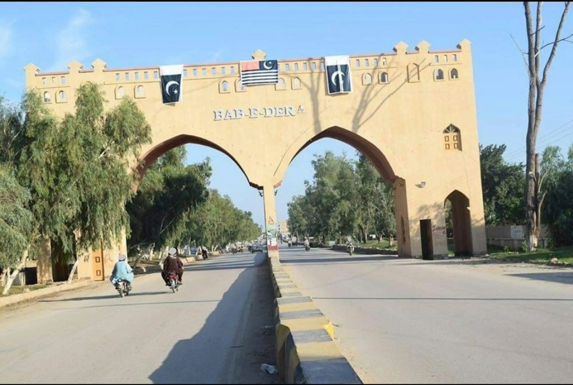
Dera Ismail Khan Postal Code Khyber Pakhtunkhwa, Pakistan
Location & Status – Dera Ismail Khan Postal Code
Dera Ismail Khan, commonly known as D.I. Khan, is an important city and administrative centre in southern Khyber Pakhtunkhwa, Pakistan. It serves as the headquarters of Dera Ismail Khan District and is an important commercial, agricultural, educational, and transportation centre of the region.
The city is situated along the western bank of the Indus River and forms an important link between Khyber Pakhtunkhwa, Punjab, and Balochistan.
Dera Ismail Khan is geographically connected with:
- Tank District to the west
- South Waziristan to the west and northwest
- Lakki Marwat to the north
- Bhakkar District, Punjab across the Indus River to the east
- Dera Ghazi Khan toward the southeast
Approximate Distances – Dera Ismail Khan Postal Code
- Islamabad to Dera Ismail Khan: approximately 300–320 km
- Peshawar to Dera Ismail Khan: approximately 280–300 km
- Bannu to Dera Ismail Khan: approximately 120 km
- Tank to Dera Ismail Khan: approximately 60 km
- Multan to Dera Ismail Khan: approximately 330 km
- Lahore to Dera Ismail Khan: approximately 500 km
- Karachi to Dera Ismail Khan: approximately 1,000 km
The city is connected through:
- Indus Highway
- Dera Ismail Khan–Peshawar road network
- Dera Ismail Khan–Multan road connections
- Dera Ismail Khan Airport
- Regional highways connecting southern Khyber Pakhtunkhwa with Punjab and Balochistan
Population – Dera Ismail Khan Postal Code
Dera Ismail Khan City
Dera Ismail Khan is a major urban centre in southern Khyber Pakhtunkhwa, with a population of several hundred thousand within the wider urban area.
Dera Ismail Khan District – Dera Ismail Khan Postal Code
The district has a population of more than one million residents, spread across urban centres, towns, villages, and rural communities.
The wider district includes important towns and localities such as:
- Dera Ismail Khan
- Paharpur
- Kulachi
- Daraban
- Paroa
- Yarik
- Paniala
- Darazinda
- Choudhwan
- Ramak
Administrative Structure – Dera Ismail Khan Postal Code
Administrative Status
Dera Ismail Khan serves as the headquarters of Dera Ismail Khan District and is one of the principal administrative centres of southern Khyber Pakhtunkhwa.
Major Administrative Areas
Important administrative areas associated with the district include:
- Dera Ismail Khan
- Paharpur
- Kulachi
- Daraban
- Paroa
The district administration is responsible for:
- Municipal services
- Education
- Healthcare
- Public administration
- Agriculture
- Irrigation
- Road infrastructure
- Rural development
- Disaster management
- Local government services
Geography & Background – Dera Ismail Khan Postal Code
Area
Dera Ismail Khan District covers a large area of southern Khyber Pakhtunkhwa, extending from the Indus River plains toward the foothills and mountainous areas along its western side.
Terrain
The region is characterized by:
- Indus River plains
- Agricultural land
- Semi-arid landscapes
- Low hills
- Mountain foothills
- Irrigation canals
- Seasonal streams
The Indus River is one of the most important geographical features of the area and supports agriculture and local livelihoods.
Major Geographical Features
Important geographical features around Dera Ismail Khan include:
- Indus River
- Sulaiman Mountain foothills
- Gomal River
- Chashma Right Bank Canal
- Agricultural plains
- Gomal region
Climate
Dera Ismail Khan has a predominantly hot and semi-arid climate.
The region experiences:
- Very hot summers
- Warm to mild winters
- Relatively low rainfall
- Seasonal monsoon rainfall
- Cooler winter nights
Summer temperatures can become extremely high, while winter generally remains considerably milder than the mountainous areas of northern Khyber Pakhtunkhwa.
Historical Background – Dera Ismail Khan Postal Code
Dera Ismail Khan has a long history connected with the settlements and trade routes of the Indus region and the surrounding frontier areas.
The city and surrounding region historically served as an important link between the Indus plains, Afghanistan, and the tribal and mountainous areas to the west.
The modern city developed as an important settlement in the nineteenth century and became increasingly significant under British administration because of its strategic location and connections with surrounding regions.
After the creation of Pakistan in 1947, Dera Ismail Khan became an important administrative and commercial centre of Khyber Pakhtunkhwa.
Today, the city is recognized for its agricultural economy, universities, historic sites, regional markets, and strategic location between Khyber Pakhtunkhwa and Punjab.
Languages & Culture – Dera Ismail Khan Postal Code
Widely Spoken Languages
Languages commonly spoken in Dera Ismail Khan and surrounding areas include:
- Saraiki
- Pashto
- Urdu
- English
Saraiki has a particularly strong cultural and linguistic presence in the southern parts of the district, while Pashto is also widely spoken.
Official Language – Dera Ismail Khan Postal Code
Urdu is Pakistan’s national language and is widely used for official communication, education, and administration.
Dera Ismail Khan is known for its:
- Saraiki culture
- Pashtun traditions
- Traditional music
- Local poetry
- Handicrafts
- Regional cuisine
- Agricultural traditions
- Traditional hospitality
- Cultural festivals
Daily Life & Economy – Dera Ismail Khan Postal Code
The economy of Dera Ismail Khan is supported by:
- Agriculture
- Livestock
- Trade
- Government employment
- Education
- Healthcare
- Small businesses
- Transport
- Wholesale markets
- Construction
- Services
Agriculture is particularly important because of the fertile land and irrigation systems associated with the Indus River and canal network.
Major Agricultural Products – Dera Ismail Khan Postal Code
Important crops and agricultural products include:
- Wheat
- Sugarcane
- Rice
- Maize
- Chickpeas
- Fruits
- Vegetables
- Dates
The region is also known for livestock farming and agricultural trade.
Education & Institutions – Dera Ismail Khan Postal Code
Dera Ismail Khan is an important educational centre in southern Khyber Pakhtunkhwa.
Major educational institutions and facilities include:
- Gomal University
- D.I. Khan Polytechnic Institute
- Agricultural research facilities
- Schools and colleges
- Technical and vocational institutions
The presence of Gomal University has contributed significantly to higher education and research in the region.
Tourism & Places of Interest – Dera Ismail Khan Postal Code
Dera Ismail Khan and its surrounding district offer a combination of cultural, historical, agricultural, and natural attractions.
Places and features associated with the region include:
- Indus River
- Gomal region
- Kulachi
- Daraban
- Paharpur
- Chashma Right Bank Canal
- Historic settlements
- Local bazaars
- Traditional cultural sites
The district’s location near the Sulaiman foothills also provides access toward the mountainous areas of western Khyber Pakhtunkhwa.
Frequently Asked Questions (FAQs) – Dera Ismail Khan Postal Code
1. Where is Dera Ismail Khan located?
Dera Ismail Khan is located in southern Khyber Pakhtunkhwa, Pakistan, along the western bank of the Indus River.
2. What is the postal code of Dera Ismail Khan?
The main postal code of Dera Ismail Khan GPO is 29050.
3. Which areas come under Dera Ismail Khan GPO?
Postal areas associated with the Dera Ismail Khan GPO include:
- Dera Ismail Khan
- Dera Township
- Muryali
- Din Pur
- Paharpur
- Band Kurai
- Bilot
- Daraban
- Darazinda
- Paniala
- Yarik
- Wanda Khan Muhammad
- Rehmani Khel
- Saddar Bazar
- Fort Iqbal Garh
- Kachi Paind Khan
- Kachamali Khel
- Kirri Khaisor
- Chishma Right Bank Canal
- Kot Jai
- Mandhara
- Rangpur
- Gomal University New Campus
- Paroa
- Ramak
- Kiri Shamozai
- Musa Zai
- Choudhwan
- Kulachi
- Takwara
4. What is Dera Ismail Khan famous for?
Dera Ismail Khan is known for:
- Indus River
- Agriculture
- Saraiki culture
- Pashtun culture
- Gomal University
- Traditional markets
- Regional handicrafts
- Historical settlements
- Gomal region
- Its strategic location in southern Khyber Pakhtunkhwa
5. Which languages are spoken in Dera Ismail Khan?
Commonly spoken languages include:
- Saraiki
- Pashto
- Urdu
- English
6. What is the climate like in Dera Ismail Khan?
Dera Ismail Khan generally experiences:
- Very hot summers
- Mild to cool winters
- Semi-arid conditions
- Seasonal rainfall
- High temperatures during summer
7. What are the major sources of income in Dera Ismail Khan?
The local economy depends largely on:
- Agriculture
- Livestock
- Trade
- Government employment
- Education
- Healthcare
- Transport
- Small businesses
- Services
8. Why is Dera Ismail Khan important in Pakistan?
Dera Ismail Khan is an important city in southern Khyber Pakhtunkhwa because of its strategic location along the Indus River, agricultural economy, regional trade connections, educational institutions, and links between Khyber Pakhtunkhwa, Punjab, and western mountainous areas.
9. What is the main Dera Ismail Khan GPO postal code?
The main Dera Ismail Khan GPO postal code is 29050.
10. What is the postal code of Paharpur, Dera Ismail Khan?
The postal code of Paharpur is 29160, according to the postal-code list provided.
11. What is the postal code of Kulachi?
The postal code of Kulachi is 29350.
12. What is the postal code of Daraban?
The postal code of Daraban is 29310.
13. What is the postal code of Yarik?
The postal code of Yarik is 29020.
14. What is the postal code of Paniala?
The postal code of Paniala is 29000.