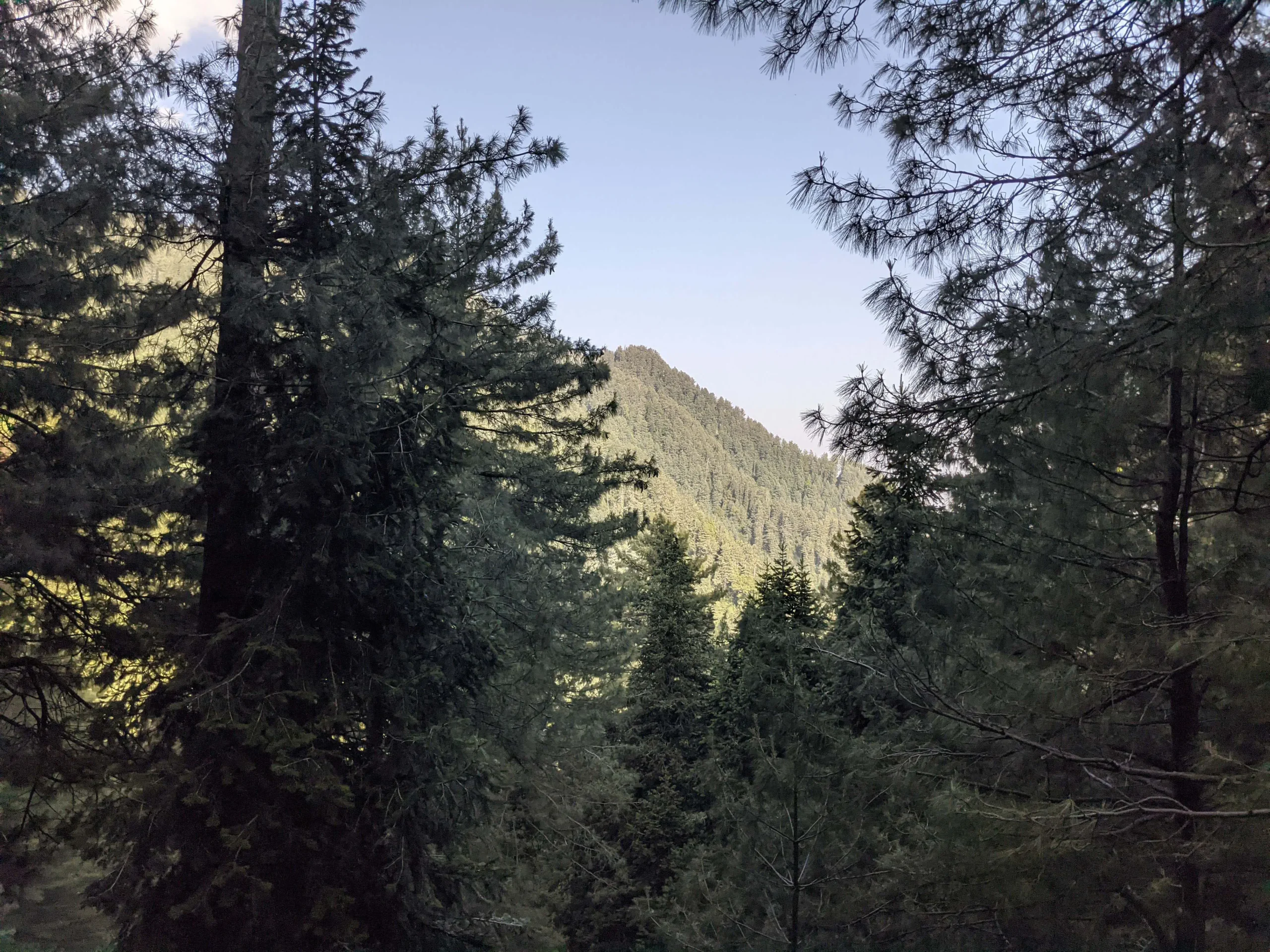
The Mushkpuri Top Weather Widget is a specialized, real-time trekking companion engineered specifically for the unique alpine environment of the Galiyat region. By pulling live meteorological data directly from the peak’s coordinates, it provides hikers with a high-precision look at the Mushkpuri Top temperature, wind chill, and visibility at an elevation of 2,800 meters. The integrated “Hiker’s Advisory” simplifies complex weather patterns into practical trail safety tips, instantly notifying trekkers if the path is clear, muddy from recent rain, or requires specialized snow gear like crampons and trekking poles.
Beyond basic metrics, the Weather in Mushkpuri Top widget features a sleek, mobile-responsive hourly trekking slider and a 5-day forecast, allowing adventurers to time their ascent to catch the perfect 360-degree view of the Himalayas and the Jhelum River. Designed with a clean, high-contrast aesthetic, the widget supports both light and dark modes to remain perfectly readable under the bright mountain sun or in the low light of a pine forest. This makes it an indispensable digital tool for anyone navigating the scenic trails from Nathia Gali or Dunga Gali to one of Pakistan’s most iconic summits.
Mushkpuri Top Weather: FAQ
1. What is the total height of Mushkpuri Top?
Mushkpuri Top stands at an elevation of approximately 2,800 meters (9,200 feet) above sea level. It is the second-highest peak in the Galiyat region after Miranjani.
2. How long does the trek take?
The uphill hike typically takes 2 to 3 hours depending on your pace and the route chosen. The descent usually takes about 1.5 to 2 hours.
3. Which route is better: Nathia Gali or Dunga Gali?
- Nathia Gali Route: Longer (approx. 4 km) but has a gentle, steady incline. It is highly recommended for families and beginners.
- Dunga Gali Route: Shorter (approx. 2.8 km) but much steeper and more taxing. Choose this if you want a faster, more “adventurous” climb.
4. Is the trek safe for children and elderly people?
Yes, the Nathia Gali route is considered beginner-friendly. However, the elderly should have a reasonable fitness level, and children should be supervised, especially near the top where the meadows open up.
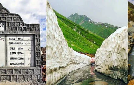
5. Can I visit Mushkpuri Top in the winter (December–March)?
Yes, but it is a snow trek. The trail becomes very slippery and can be dangerous without proper gear like crampons or sticks. In March 2026, expect deep snow patches and freezing winds at the summit.
6. Is there a mobile network available at the top?
Generally, yes. Most major Pakistani networks (SCOM, Telenor, Zong) have decent coverage at the peak, though signals can be spotty within the thick pine forests during the climb.
7. Are there any dangerous animals on the trail?
The trek passes through Ayubia National Park, which is home to common leopards and monkeys. Leopards are nocturnal and stay away from humans during the day, but it is strictly advised to leave the top before sunset to avoid any encounters.
8. Can I find water or food at the summit?
No. There are no shops or water sources at the top. You must carry sufficient water (at least 1.5 liters per person) and high-energy snacks from the base.
9. Is camping allowed at Mushkpuri Top?
As of early 2026, overnight camping is generally discouraged or restricted by local authorities due to wildlife safety (leopards) and lack of facilities. Most visitors treat it as a day trip.
10. Do I need a professional guide?
For the main trails, a guide is not strictly necessary, as the paths are well marked. However, if you are hiking in deep winter snow or taking the forest routes for the first time, a local guide can be helpful for safety.
11. What should I pack for a day hike?
Essential items include:
- Sturdy hiking shoes with a good grip.
- A lightweight windbreaker or warm jacket (it’s cold at the top even in summer).
- A hiking stick.
- Sunscreen and sunglasses (the UV index is high at this altitude).
12. Can I take a horse to the top?
Yes, horse services are available at the base of both Nathia Gali and Dunga Gali. This is a common option for those who find the steep incline difficult.
13. What can I see from the top on a clear day?
You can enjoy a 360-degree view including the Jhelum River, the hills of Azad Kashmir, and even the distant, majestic peak of Nanga Parbat on exceptionally clear days.
14. Are there restrooms on the trail?
No. Restrooms are only available at the starting points in Nathia Gali or Dunga Gali. Plan accordingly before you start the ascent.
15. What is the best month to see greenery?
The peak is at its greenest during the Monsoon tail-end (August and September). During this time, the meadows are covered in wildflowers and lush grass, though you should check the weather for rain alerts.


